
I am text block. Click edit button to change this text. Lorem ipsum dolor sit amet, consectetur adipiscing elit. Ut elit tellus, luctus nec ullamcorper mattis, pulvinar dapibus leo.
I am text block. Click edit button to change this text. Lorem ipsum dolor sit amet, consectetur adipiscing elit. Ut elit tellus, luctus nec ullamcorper mattis, pulvinar dapibus leo.
I am text block. Click edit button to change this text. Lorem ipsum dolor sit amet, consectetur adipiscing elit. Ut elit tellus, luctus nec ullamcorper mattis, pulvinar dapibus leo.
I am text block. Click edit button to change this text. Lorem ipsum dolor sit amet, consectetur adipiscing elit. Ut elit tellus, luctus nec ullamcorper mattis, pulvinar dapibus leo.
I am text block. Click edit button to change this text. Lorem ipsum dolor sit amet, consectetur adipiscing elit. Ut elit tellus, luctus nec ullamcorper mattis, pulvinar dapibus leo.
Software Application Development
USMC – Range & Training Programs Division (RTPD)
ARMY – TRADOC Capabilities Manager, Ranges (TCM-R)
Navy – Fleet Forces Command (FFC)
USAF – Air Combat Command (ACC)
Foreign Military Sales (FMS)
POWERFUL GIS SOFTWARE AT YOUR FINGERTIPS
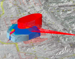
Geographic information systems (GIS) provide a framework for analyzing spatial locations, visualizing maps, gathering data, and more. Ultimately, GIS helps leaders make informed, practical decisions.
We develop lightweight and fast desktop, web-based, and mobile GIS software solutions for a variety of organizational needs giving you immediate access to relevant data. Our web-based and mobile software, updates and syncs with desktop applications for smooth, instantaneous operations.
Following best practices as outlined in DISA’s Security Technical Implementation Guide (STIG), we continually test our software to ensure accuracy and compliance. Our developers use hardware capable of running on secure DoD environments.
All of our software comes with thorough documentation, including release-level software design diagrams, architecture views, external interface documents, and user role matrixes. We provide everything necessary for implementation. Our Range Managers Tool Kit (RMTK) GIS applications currently support the USMC, Army, Navy, USAF, and FMS countries

OUR EXPERTISE
AREAS OF EXPERTISE
Our customers know they can depend on us for valuable support and assistance, no matter the
challenge. Federal Strategies is well equipped to offer support and solutions in the following areas


